
There are clear signs that Australia is moving away from wet La Niña weather into a drier and hotter phase, with international forecasters agreeing that there are high chances for El Niño to dominate the upcoming winter season.
This phenomenon started last spring and resulted in above average rainfall, floods in several states, as well as alleviation of drought conditions in the country’s central regions.
However, the weather picture looks different today, and as of 26 April, the temperature of Niño3.4 index was at 0.23°C, while in two weeks the region has become 0.5°C warmer.
It is this warming under the sea that alarms climate researchers all around the world, as it shows a significant amount of anomalously warm water situated at a depth ranging from 50 to 250 meters, with anomalies reaching 6°C in some regions.
The existence of such a vast heat reservoir under the water is considered by meteorologists as a trigger that will lead to a rapid transition to El Niño conditions.
Based on the models surveyed by the Bureau, the Bureau and major international centres expect the tropical Pacific will continue to warm and reach El Niño thresholds later in the year.
Some models show conditions crossing that line as early as May, others show a slower build through July.
Last week, the World Meteorological Organization had a pointed assessment. “There’s a clear shift happening in the equatorial Pacific, sea surface temperatures are rising quickly, according to its latest Global Seasonal Climate Update.
Tech News: Meta to cut 8000 jobs as tech giant funnels billions into AI
The growing concern is compounded by the possibility of this event turning strong.
The NOAA Climate Prediction Centre has estimated there is about a 25% chance of a very strong El Niño forming towards the end of the year, a scenario sometimes called a “super El Niño” when temperatures in the key tracking region are over 2°C above normal.
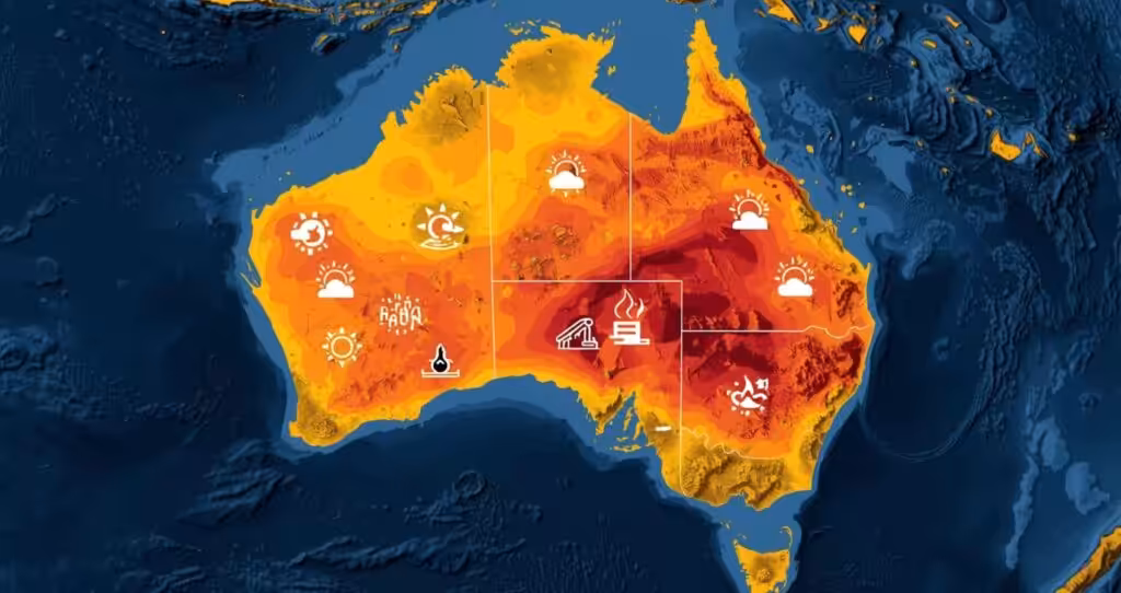
What it means for Australia
During winter and spring seasons, El Niño would result in decreased rainfall throughout the vast majority of Australia, warmer than normal maximum temperature throughout most areas except in the tropical zone, increased bushfire risk, less snowfall in the Australian Alps and increased frequency of frosts.
Below average rainfall is expected from May to July for much of eastern Australia and southwest regions.
On the other hand, the forecast shows little clarity about rainfall in most other zones since there is an equal probability of having wet or dry spells in these regions.
Nevertheless, the Bureau warned against any attempts to make long term predictions.
They include Indian Ocean Dipole, localized sea surface temperature, and long term climatic trend.
Moreover, every El Niño phenomenon is unique, which means that even a highly positive index may not necessarily correspond with equally adverse effects in the country.
Forecasters admit the so called autumn predictability barrier, when long range models tend to be less reliable, has not yet fully passed.
The WMO said confidence in the forecasts generally rises after April, so the picture should become much clearer in the coming weeks.
The Pacific is warming fast, the model consensus is unusually strong for this time of year and the La Niña driven wet weather seems firmly in the past.
The data sends a clear message to farmers, water managers, fire authorities and anyone planning an Australian winter be prepared for a drier and warmer season than in recent years.