
Adelaide is preparing for a hit of heavy rain this weekend, with flood watches issued and emergency services warning that conditions could quickly change as a tropical low moves south through the state.
A Flood Watch has been issued for the Torrens and metropolitan rivers and creeks, as well as catchments in large parts of the state.
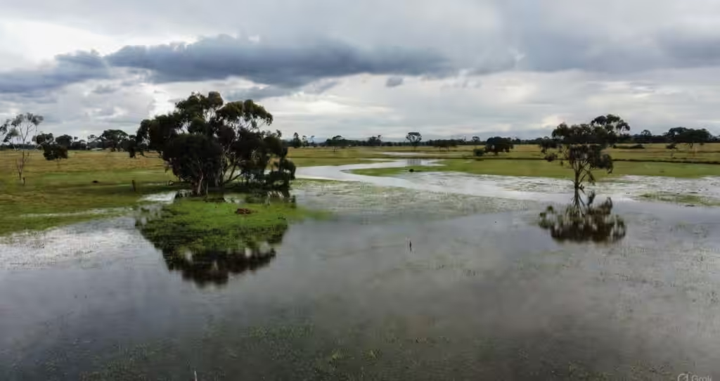
Warnings issue that river and creek rises and overland inundation could become more widespread as rain extends south from Friday and through Saturday and Sunday.
The Bureau of Meteorology has issued warnings for severe weather, with flash flooding possible in some areas due to heavy rain with totals of 30 to 70mm in six hours and 40 to 80mm in a day and isolated totals of 120mm.
Also Read: Teen dies in Australian first after tick bite triggers deadly meat allergy
Severe weather warnings are current on Friday for parts of the West Coast, Eyre Peninsula and pastoral districts with the tropical low expected to move further south over the weekend.
SES prepares for flash flooding
SA State Emergency Service crews have been working in the state’s north and a second incident management team has been established to deal with incidents in metropolitan Adelaide, the Mount Lofty Ranges and the Fleurieu Peninsula.
Stefanie Zakrzewski, SES state duty officer said: “We’re planning for the worst as best we can.”
Residents are advised to clear gutters and drains before heavier rainfall, avoid gullies and creeks as water levels rise and consider not traveling if roads are affected.
Further north, flooding has already closed many outback roads and rail services, demonstrating how quickly the system can cut off communities.
As for Adelaide, the forecast is for showers on Saturday with heavier totals on Sunday and humid conditions and the possibility of thunderstorms, which can produce a lot of rain in a short time.
The rain follows a very dry summer in Adelaide, with the city’s annual rainfall totals already in record low territory by mid February, making the rapid inundation of hard surfaces and urban drainage systems a concern when heavy rain finally does arrive.