
Tropical Cyclone Narelle is intensifying over the Indian Ocean and is moving towards a possible crossing of the coast in WA Gascoyne region, with the prediction Perth could expect between 50 and 100 mm of rain as the storm barrels south over the weekend.
Currently, as of Wednesday morning, Tropical Cyclone Narelle has strengthened back to category one strength and is positioned just over 200 kilometres northwest of Broome, moving in a southwest direction at 20 km/h.
However, the Bureau of Meteorology is predicting that by Wednesday evening, the storm will have strengthened to category two.
Severe category three by Thursday morning and by the end of Thursday, a category four storm with wind gusts exceeding 260 km/h will be possible.
Narelle, a severe category three cyclone, is expected to turn south on Friday and cross the coast between Carnarvon and Kalbarri in the early hours of Saturday, most likely close to Shark Bay and Denham.
After that, it is anticipated that the system will push inland, cross the Wheatbelt to the south, pass east of Perth and then proceed toward the Esperance coast.
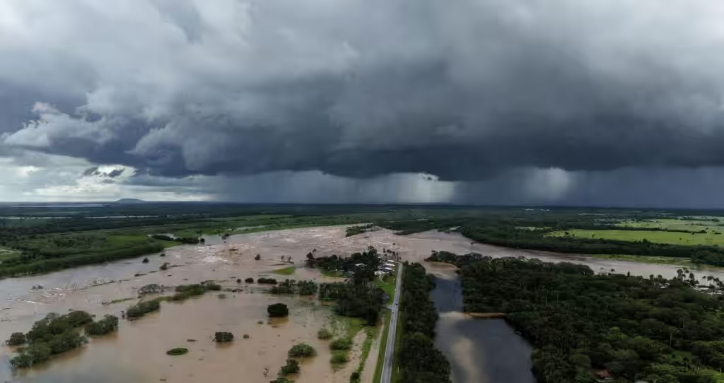
The Bureau of Meteorology senior meteorologist Angus Hines stated in his Wednesday update that the heaviest rainfall is expected between Geraldton and Bunbury, and this would include Perth.
He also stated that there would be an amount of 50 to 100 millimeters of rain in these areas. This amount of rain would be ample to cause flash flooding and rivers to burst their banks.
The weather in Perth is set to deteriorate from Friday with rain and storms developing before Narelle arrives.
However, by the time Narelle reaches Perth, it may have weakened to a category one cyclone or be a tropical low.
Narelle has had an incredible journey across Australia. Before making landfall in far north Queensland on March 20 as a category four cyclone, the system first developed over the Coral Sea in mid-March and quickly strengthened to category five.
However, the system weakened to a tropical low over land before moving into WA’s Kimberley region and then offshore to gather strength from the warm waters.
“It is the first occasion since Tropical Cyclone Ingrid in 2005 where a tropical system has affected Queensland, the Northern Territory and Western Australia.”
Also Read: Married at First Sight Star Mel Schilling Has Passed Away
In the more immediate term, the Pilbara coast is the area worst affected over the next 48 hours.
Destructive wind gusts of up to 140 km/h are possible between Karratha and Coral Bay this week, as well as large waves and abnormally high tides.
Emergency officials are already advising residents from the Pilbara region down to Perth to monitor the situation closely and to stay in touch with the State Emergency Service as the situation develops.