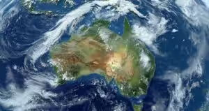

Several low pressure systems moving slowly across eastern Australia have caused rainfall in a number of places in the region during this week.
The authorities have issued warnings about rain reaching all states and territories by the end of the week.
According to observations, more than 50mm of rainfall were recorded in several places in NSW Central West within 24 hours up to Tuesday morning.
Dubbo received the highest amount of rainfall inland in NSW, 59.4mm which ties for its second wettest May day in its history since 1870.
Gilgandra, Yeoval, and Canowindra were the other cities that saw more than 50mm, while Jervis Bay Airfield on the south coast had the highest rainfall across the whole of NSW, recording 62.2mm.
The capital city of Canberra received 20mm of rainfall within only 5 hours between 6 am to 11 am on Tuesday.
A significant band of rainfall has caused rainfall in the southeastern parts of NSW as well as ACT and Sydney.
Pools of cold air high in the atmosphere have made conditions unstable since Monday, fuelling rain, thunderstorms and strong winds across South Australia, Queensland, NSW, Victoria, Tasmania, the ACT and the southern Northern Territory.
Australia Weather News: Snow, gales and rain to deliver early winter blast to Australia’s southeast
Areas in eastern and northern New South Wales and eastern Tasmania will be exposed to heavy rains and possible floods over the next few days, but other regions like the ACT, eastern parts of Victoria, and southern parts of Queensland will also be affected.
The Bureau of Meteorology has declared a flood watch for some areas of the Hunter and Mid North Coast.
]While the NSW State Emergency Service has warned about an existing low pressure system along the east coast of New South Wales and its impact on eastern parts of the region from the middle of the week.
A complex low pressure system is expected to deliver yet another bout of intense rain and thunderstorms in addition to windy conditions over the southwestern part of WA starting from Saturday.
NSW and Queensland have been particularly dry and a lot of inland areas are expected to have their best rain in months.
But forecasters have cautioned that it remains difficult to determine exactly where and how much rain will fall, given the dynamic nature of how the upper level lows will interact with each other in the coming days
Conditions can change quickly and residents in flood prone areas are encouraged to monitor BOM warnings and listen to the advice of emergency services.
People who are caught in floodwaters or need assistance during a storm can call the NSW SES on 132 500. In a life threatening emergency call Triple Zero.